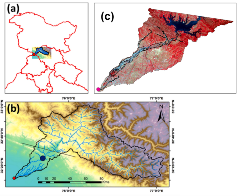
A study by researchers at the Indian Institute of Technology Gandhinagar (IITGN), published in Next Sustainability, has found significant changes in the Ravi River’s flow and floodplain following the operation of the Ranjit Sagar Dam. Analysing daily discharge data from 1980–2019 and nearly three decades of satellite imagery, the researchers found that median river discharge during April and May declined from 296 cubic metres per second in 1980–2000 to 221 cubic metres per second in 2001–2019. The estimated mean surface-water area across the floodplain fell fivefold, from 17.35 sq km to 3.46 sq km. Satellite observations also showed increased vegetation in areas where active water coverage had receded, indicating changes in floodplain dynamics and river connectivity. The study further examined the combined influence of sand mining, land-use changes and human activity on the river, although their impacts varied across the floodplain. Researchers caution that altered flow regimes and reduced sediment movement can affect river morphology, biodiversity and ecosystem functioning. The findings highlight the need for integrated river management that considers reservoir operations, sediment transport, floodplain connectivity and human interventions, alongside sustainable water-resource planning.
Source: PIB